
Discovering live webcams across the internet is like finding needles in constantly shifting haystacks. Thousands of webcams exist worldwide, but finding them, validating they work, extracting meaningful location data, and serving them efficiently requires sophisticated automation. GeoWebcams transforms this challenge into an intelligent, automated platform that discovers, processes, and serves live webcam streams from every corner of the globe.
I architected and developed this comprehensive multi-service platform combining Python automation, Rust web development, AI-powered content generation, and professional live streaming infrastructure to create a scalable system that automatically discovers and serves thousands of webcams with zero-downtime deployments.
Intuitive Discovery Experience
The platform offers an elegant, search-first interface that makes exploring the world effortless. Users are greeted with a powerful search engine that understands locations, landmarks, and categories, enabling instant discovery of webcams from bustling cities like Times Square to serene natural wonders like Norwegian fjords.
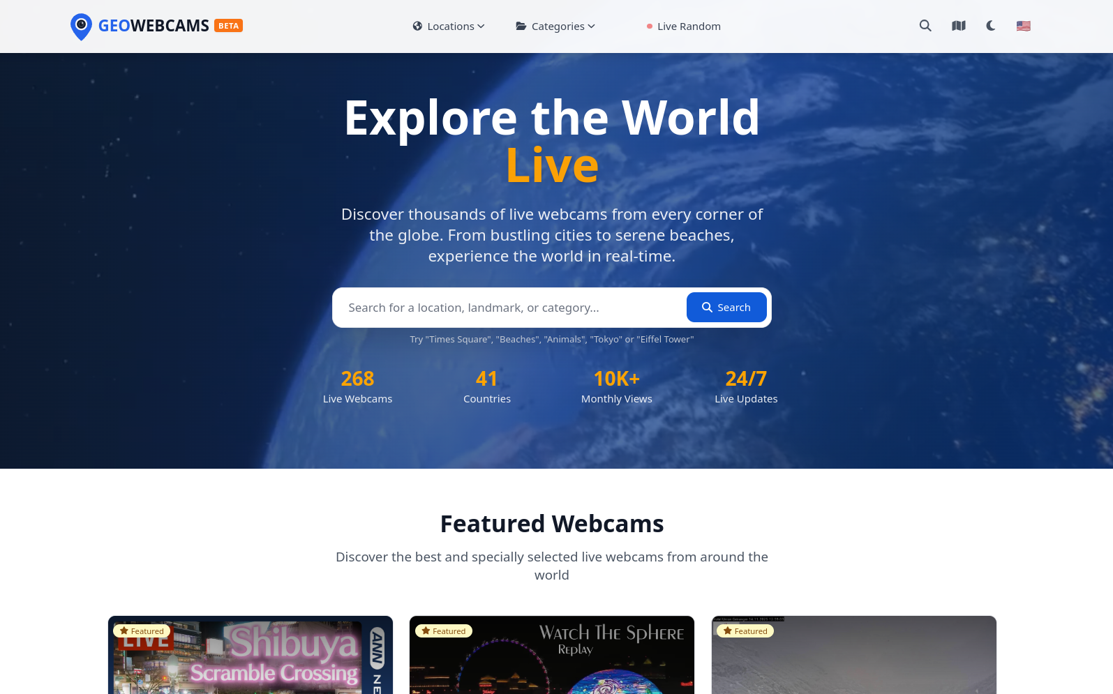
The homepage showcases real-time platform statistics: currently featuring 268 live webcams across 41 countries (with continuous growth planned to reach thousands of streams), over 10,000 monthly views, and 24/7 live updates. Featured webcams are prominently displayed, highlighting the most iconic and popular streams, including Times Square, The Sphere in Las Vegas, and breathtaking natural landscapes. This curated approach ensures users immediately discover compelling content while the search engine provides unlimited exploration possibilities.
The Challenge: Automation at Scale
Imagine building a platform that needs to:
- Discover webcam streams automatically from hundreds of different providers, each with unique technical implementations.
- Validate that streams are actually live and accessible before adding them to the database.
- Extract precise geographic coordinates and place information for webcams that often have vague or missing location data.
- Generate compelling descriptions and categorizations using AI to make webcams easily discoverable.
- Capture preview images from live video streams using computer vision.
- Serve this content through a blazing-fast web application that handles thousands of concurrent users.
- Stream live video feeds through a professional streaming server supporting multiple protocols.
- Deploy updates without downtime using Blue/Green deployment strategies.
Traditional approaches fail because:
- Manual webcam discovery doesn’t scale past a few dozen sources.
- Simple web scraping breaks constantly as providers change their sites.
- Basic location extraction produces inaccurate or incomplete geographic data.
- Server-side rendering creates bottlenecks that limit scalability.
- Monolithic applications require downtime for updates.
Architecture: Microservices with Zero-Downtime Deployment
The platform is built as a modular microservices architecture with Blue/Green deployment capability for continuous operation.
Core Services:
| Service | Technology | Purpose |
|---|---|---|
| Traefik | Go | Load balancer & SSL termination |
| Nginx | C | Internal reverse proxy (blue/green environments) |
| GeoWorkflows | Python/FastAPI | Webcam discovery & data processing engine |
| WWW | Rust/Leptos (SSR) | Public-facing web application |
| GeoStream | SRS/Node.js | Live streaming server (RTMP/SRT -> HLS) |
| Directus | Node.js | Headless CMS & API layer |
| PostgreSQL | SQL | Database with PostGIS for geospatial queries |
| Redis | C | Caching layer for performance |
Blue/Green Deployment Architecture
🔵 Blue Environment


Active environment serving production traffic
🟢 Green Environment


Standby environment for testing new versions
Zero-Downtime Deployment Process:
- Deploy new version to inactive environment (green)
- Test thoroughly without affecting production users
- Switch Traefik routing from blue to green instantly
- Monitor for issues with immediate rollback capability
- Keep previous environment ready for instant rollback
This architecture enables continuous deployment with zero downtime and instant rollback capability if issues arise.
Core Features
1. Hierarchical Category Organization
The platform implements a sophisticated taxonomy system that organizes webcams into meaningful categories and subcategories, making discovery intuitive and efficient.
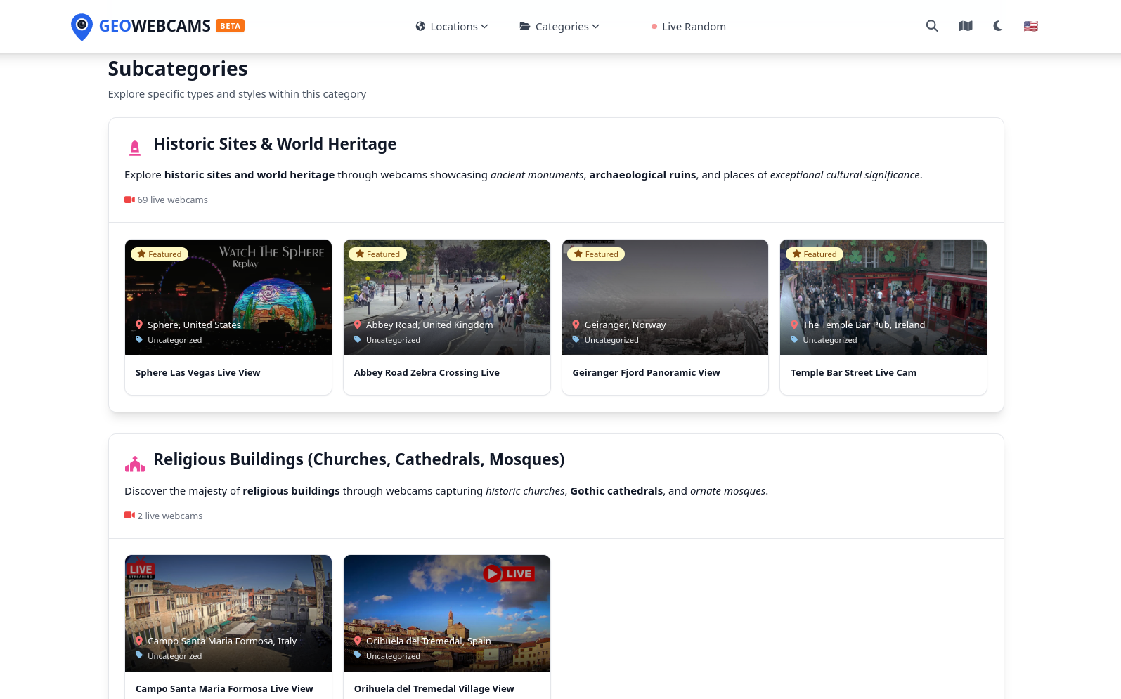
Categories like Historic Sites & World Heritage showcase famous landmarks such as The Sphere in Las Vegas, Abbey Road’s iconic zebra crossing in London, Geiranger Fjord in Norway, and Temple Bar in Ireland. Each subcategory provides curated descriptions highlighting cultural significance, with live webcam counts displayed for transparency. This AI-powered categorization automatically assigns webcams to appropriate categories based on visual and contextual analysis, creating an intuitive browsing experience.
2. Geographic Navigation System
Beyond categories, the platform offers comprehensive geographic navigation with dedicated pages for every country, region, and city where webcams are available.
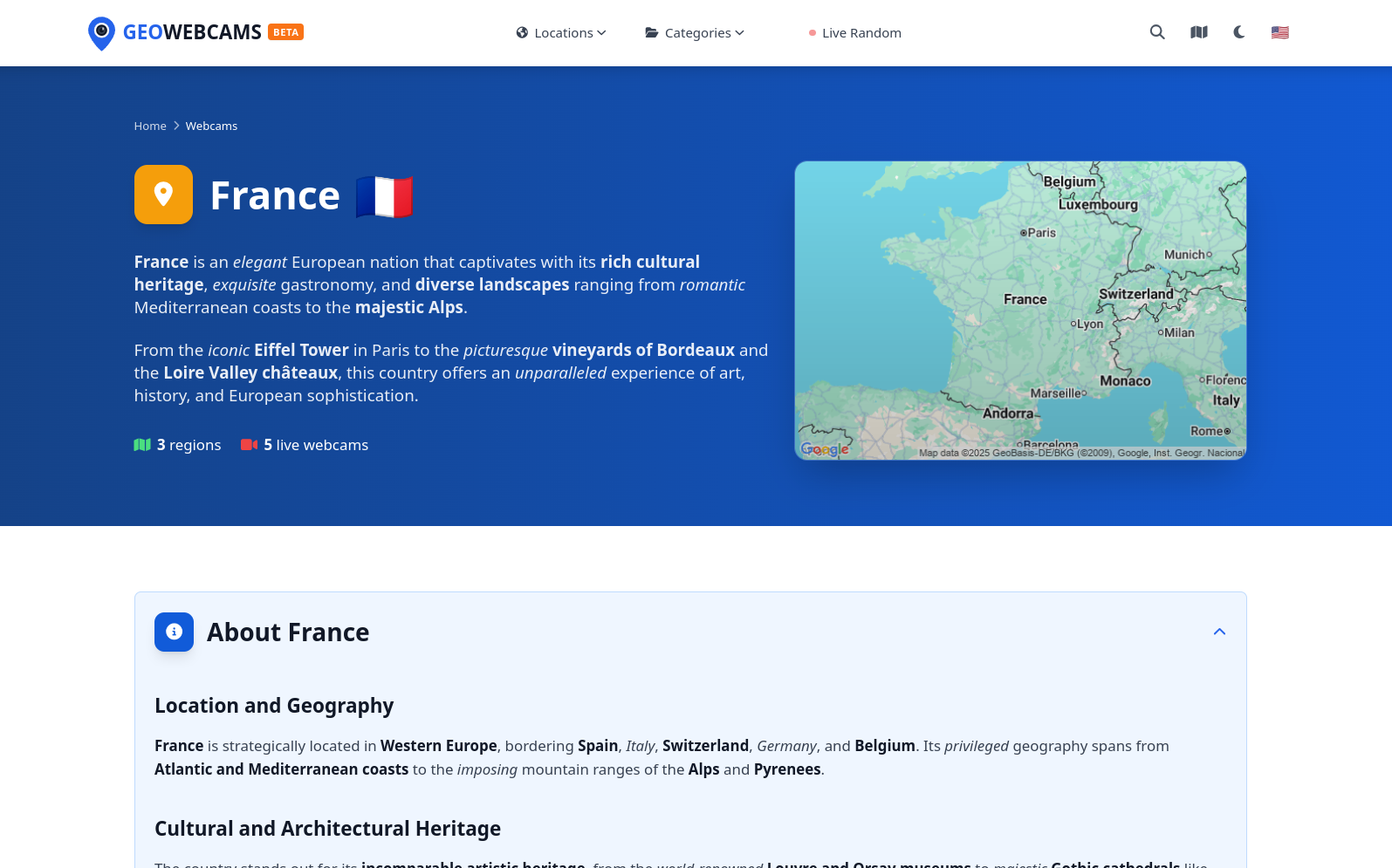
Country pages provide rich contextual information: an interactive Google Maps visualization showing webcam distribution, AI-generated descriptions highlighting cultural heritage and geographic features, and statistics showing available regions and live webcams. For example, the France page describes its rich cultural heritage, exquisite gastronomy, and diverse landscapes ranging from romantic Mediterranean coasts to the majestic Alps, with 3 regions and 5 live webcams currently available. This multi-level geographic hierarchy enables users to explore the world systematically, discovering webcams by continent, country, region, or city.
3. Serendipitous Discovery
For users seeking adventure, the platform includes a Feeling Adventurous? feature that transports users to random webcams around the world with a single click.
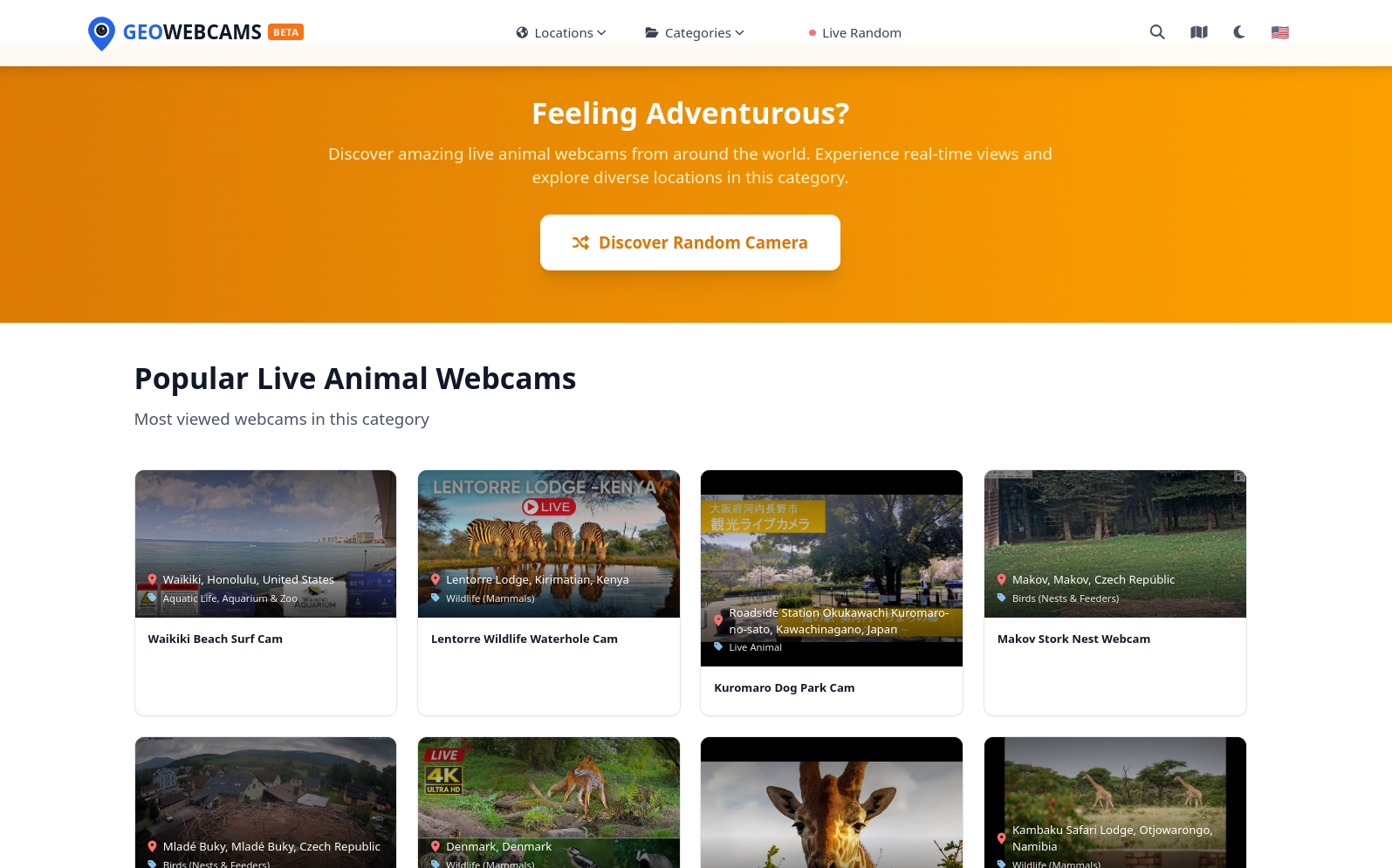
This gamified discovery mechanism showcases popular animal webcams including wildlife safaris from Kenya (Lentorre Wildlife Waterhole), stork nests in the Czech Republic, and dog parks in Japan. Each webcam displays clear LIVE indicators, location information, and category tags. The random discovery feature encourages exploration beyond user preferences, revealing unexpected corners of the world and fostering a sense of global connection.
4. Comprehensive Webcam Detail Pages
Each webcam has a dedicated detail page providing complete information and an integrated live stream player.

Detail pages feature a professional video player with playback controls, displaying the live stream in high quality. Above the player, AI-generated descriptions provide context: Watch continuous aviation action at the world’s busiest airports! Experience live aircraft movements on LAX runways 25L and 25R from this exclusive elevated vantage point atop the H Hotel Los Angeles. The page includes precise location information (Los Angeles International Airport), category tags (Airports - Runways & Terminals), and the current time in the webcam’s timezone. This level of detail transforms casual browsing into an informative, immersive experience.
5. Intelligent Webcam Discovery Engine (GeoWorkflows)
Behind the scenes, the GeoWorkflows engine is a sophisticated Python-based workflow system that automates the entire webcam discovery and processing pipeline:
12-Stage Processing Pipeline:
- Discovery - Web crawling with provider-specific extractors for EarthCam, Skyline Webcams, Ibericam, YouTube, and generic sources
- Filtering - Duplicate detection and quality assessment
- Validation - Stream accessibility verification using protocol-specific validators
- Capture - Preview image generation using OpenCV and FFmpeg
- Public Images - Extraction of promotional images from provider sources
- Place Extraction - Geographic data extraction and validation using Google Places API
- AI Descriptions - Compelling descriptions generated using LLM models via OpenRouter
- Place Descriptions - Administrative division descriptions for context
- Static Maps - Google Maps generation for all administrative levels
- Categorization - AI-powered category assignment based on visual and contextual analysis
- Scoring - Quality and relevance evaluation for ranking
- Database Insert - Structured data storage in Directus CMS
Technical Implementation:
- FastAPI provides a RESTful API for workflow execution and monitoring
- Async/Await patterns enable high-performance concurrent processing
- Dynamic Workflow Loading allows adding new workflows without downtime
- Loguru Integration provides structured logging with full traceability
- Dependency Injection manages shared resources (database connections, HTTP sessions, API keys)
Technical Achievements
Work in Progress
GeoWebcams is an ongoing project with continuous development planned for the coming months:
Immediate Roadmap:
- Enhanced map-based search with interactive clustering
- Real-time stream status monitoring and automatic validation
- User accounts with favorite webcams and custom collections
- Mobile applications for iOS and Android
Future AI Enhancements:
- Migration to advanced multi-agent architecture (CrewAI + LangGraph)
- Implementation of sophisticated prompt optimization with DSPy
- Integration of CAgent for automated development workflows
- Collaborative AI agents for enhanced content quality
Conclusion
The GeoWebcams project represents a comprehensive exploration of modern web architecture, combining the performance benefits of Rust SSR with the flexibility of Python automation, the intelligence of AI-powered content generation, and the reliability of microservices architecture.
This project demonstrates how different technologies can be orchestrated into a cohesive platform:
- Python handles complex data processing workflows with excellent ecosystem support
- Rust delivers fast server-side rendering with type safety and performance
- AI/LLM integration automates content generation at scale
- Microservices architecture enables independent scaling and deployment
- Blue/Green deployment ensures continuous availability
As development continues, the platform will evolve to incorporate cutting-edge multi-agent AI architectures, demonstrating how CrewAI, LangGraph, LangChain, DSPy, and CAgent can work together to create intelligent, self-improving systems.
Key Takeaways for Similar Projects
- Microservices enable flexibility - Independent services can be updated, scaled, and replaced without affecting the entire system
- Blue/Green deployment eliminates downtime - Critical for platforms requiring 24/7 availability
- SSR-only approach maximizes performance - Pure server-side rendering eliminates hydration delays and minimizes client-side JavaScript
- AI automation scales content creation - LLMs can generate high-quality content at a fraction of the cost and time
- Multi-agent AI represents the future - Sophisticated orchestration of specialized agents will enable unprecedented automation
Interested in similar architectures?
For businesses needing:
- Automated data discovery and processing from diverse sources.
- AI-powered content generation at scale with quality control.
- High-performance web applications using Rust with SSR-only architecture.
- Microservices architecture with zero-downtime deployment.
- Geospatial data management and advanced geographic queries.
The combination of Python, Rust, AI, and modern DevOps practices showcased in GeoWebcams provides a proven blueprint for scalable, intelligent platforms.
I’m available for consulting and development on similar projects, bringing expertise in multi-language architectures, AI integration, and production-grade deployment strategies.
Get in touch ->
About the author
Business Flow Navigator Inc.
Tech entrepreneur and cloud architect with over 20 years of experience transforming infrastructures and automating processes. Specialist in AI/LLM integration, Rust and Python development, and AWS & GCP architecture.
Related projects
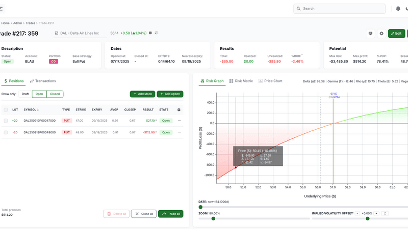
Option Panel - High-Performance Rust Options Trading Platform
Professional web-based options analysis platform combining the power of Rust and WebAssembly to perform complex financial calculations with exceptional performance, including Greeks analysis, multi-leg strategies, risk assessment and profitability evaluation with ultra-low latency.
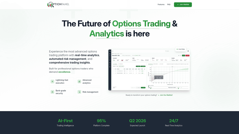
Option Panel - Modern Landing Page with Astro and Tailwind CSS
High-performance static landing page for professional options trading platform, built with Astro, Tailwind CSS, and JavaScript. Directus CMS integration for lead management with advanced spam and fraud protection. 1-week development timeline.

AWS Infrastructure Optimization for Virtway Metaverse - Aurora Serverless v2 and intelligent autoscaling
Highly scalable AWS architecture designed to support virtual events with extreme traffic spikes for Virtway Metaverse. Implementation of Aurora Serverless v2 with multi-layer hybrid autoscaling, optimized RDS Proxy and advanced scaling strategies that reduced latency and costs while ensuring availability during connection avalanches.